We had two nights in Naracoorte and stayed in the showgrounds, did one of the famous Naracoorte cave tours, the Victoria Fossil Cave tour where there have been fossils and bones dug up from
100 000 years ago and are so important to the history of palaeontology the caves are World Heritage Listed and David Attenborough has even crawled around in here and filmed a documentary.
We had a two for one meal at the local pub, walked the town and checked out the history and admired all the original buildings of the 1850 era. The Info centre had a display of robotics for shearing sheep that was quite humorous and I think it cost the inventor about $10 000 000 of investing money for it all to fail. On our way out of town we stopped at Bool Lagoon...a HUGE lagoon for the birds to nest and many species have a stopover from Russia and China for a rest. There is a gravel road to drive to a hill and get a view of the whole lagoon but when we got to the highest point we noticed there was something missing...water...the lagoon was bone dry and back to the info notice board we were supposed to pay a fee before entering any of the protected area of the lagoon...Ooops...See Yah.
That’s another town done and we were on our way to Mt Gambier (the history of volcanoes, one of Steve’s favourite subjects), but on the way we stopped in Penola. I never get sick of looking at the stone cottages and reading about the history of these places. Penola is famous for the start of Mary Mackillop’s governing and teaching career. Every one of these towns has a huge bakery and Penola is no different so we stopped in for lunch and we will continue on our travels to find the best bakery in Australia…someone has to do it! I found Petticoat Lane which was recorded as the first street in Penola and there are still some of the original cottages here and the street still has original timber curbing lining the street.
Just as well we have nowhere to be, by the time we have lunch and visit the history rooms and walk the streets of these little towns hours fly by.
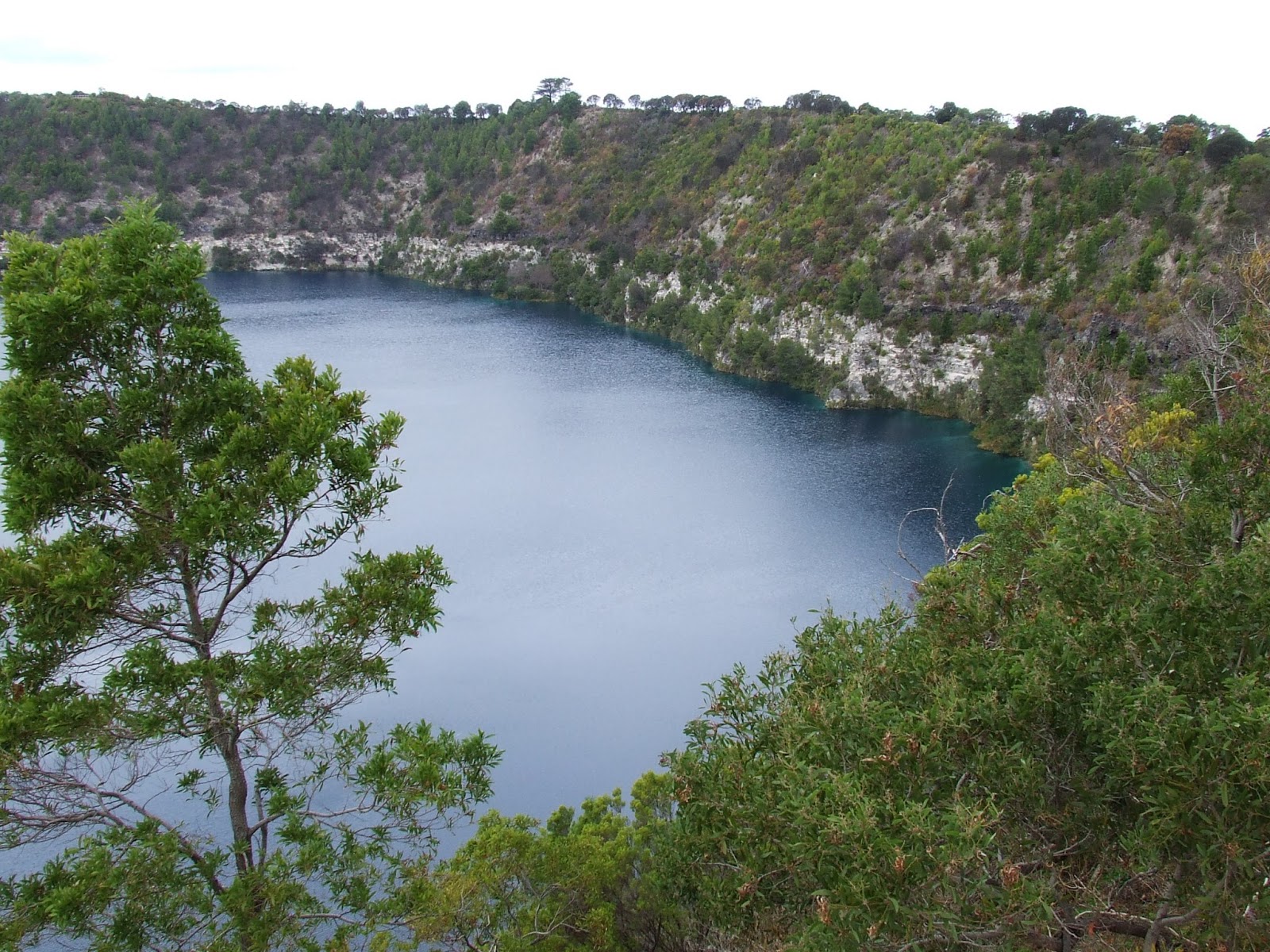
Found the showgrounds in Mt Gambier where we camped for three nights, $15 unpowered site with plenty of hot water for the showers and flushing toilets. Saturday and Sunday we had horse floats arrive at the showgrounds for riders having show jumping lessons and that was interesting to watch while we had our morning cuppa. For all the geology nuts out there, Mt Gambier is formed by erupting volcanic activity (a long time ago) and we learnt about this in the town centre watching a free 3d movie explaining the formations of the whole area…well worth watching. Mt Gambier is formed of Lakes and underground limestone caves, and it all becomes very interesting when we could actually see the volcanic cones, sinkholes (in the middle of town), the entrances to dive caves and the ripples forming hills in the landscape where former shorelines were many years ago.
 |
| Blue Lake |
 |
| Cave Garden |
 |
| Umpherston Sinkhole |
 |
| Engelbrecht Cave |
 |
| dive cave entrance at bottom of stairs |
 |
| The garden in Umpherston Sinkhole |
 |
| Lives in the Sinkhole |
 |
| entrance to Engelbrecht Cave |
Sunday morning we left and headed for the coast, there are so many things close by to Mt Gambier you could easily base yourself there and do day trips. Mt Schank (a dormant volcano) is only 13 km away and we stopped to have a look and we climbed the stairs to the rim of this classic cone shaped hole in the ground and what a view across to the coast and back to Mt Gambier and on the rim we got to see the ripples of hills across the farm paddocks of previous shorelines we were told about. It took us about 1 hour to walk up and around the whole rim, we could have walked down into the bottom of the cone but gave that a miss, we weren’t too keen on the walk back up.
 |
| The inside of Mt Schank Volcano |
 |
| Ripples in the landscape of previous shorelines |
 |
| View of another volcanic vent and the cattle below |
 |
| Standing on the rim of Mt Schank |
Morning tea back at the car and drove to the famous Piccaninnie Ponds to have a look. From the top it looks just like any other duck pond but if we had a permit and were registered with the Cave Divers Association of Australia we would find a huge cavern under the water surface that leads to under water limestone caves.
You can’t even tell how deep the water is on the edge because the water is so clear. The closest we got was to stand on the platform where the divers enter the water.
Pt MacDonnell was next where we stopped at the jetty and made ourselves some lunch but we gave in to the cold weather and bought some hot chips (and if you know how I love my hot chips) they were some of the best hot chips we have tasted for ages. Hahaha.
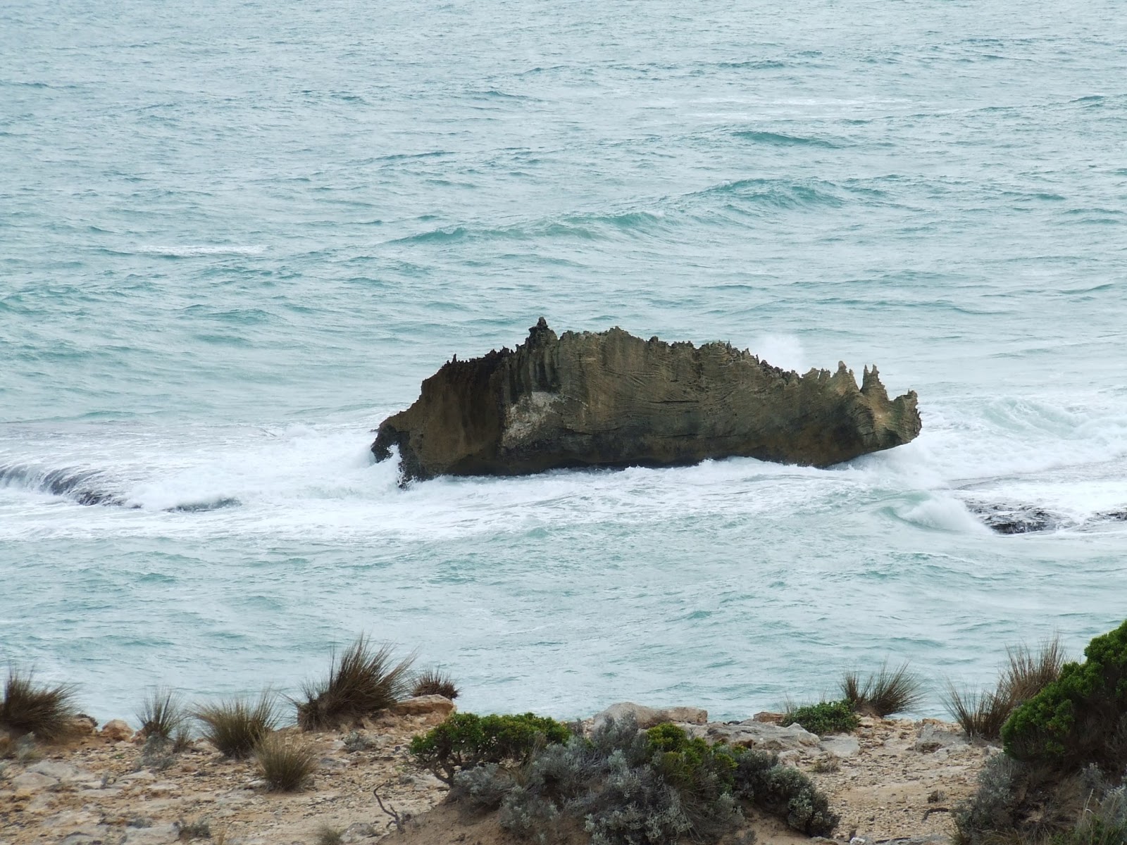
The Limestone Coast is quite obvious, the cliffs get under cut by the bashing of the waves makes for an amazing landscape. There are so many underwater reefs and rocks no wonder there was so many shipwrecks back in the day, one shipwreck mentioned a lot, the ‘Admella’ has quite an interesting story with most lives lost.
 |
| Camel Rock |
 |
| Rhino Rock (looks more like a horny devil lizard) |
 |
| This one looks a bit like an Iguana |
We decided to camp in the NP at Southend. Drove a little cross country with the help of the GPS through Tarantoola and Millicent…bummer rain again…and down to a gravel road along the coast and found it…Kotgee Campground.
No one here, which we have found a lot where we go, ended up being a cold and wet night, that goodness we decided not to set out the canvas.
Today, Mon 27 May, is warmish 16C and we are on our way along the coast through Beachport, did an 8km scenic drive, and then back on the road to Robe. At Robe, bakery stop for a cuppa and then a $10 pub meal at the Caledonian Inn…mmmmm. Then out to find a camp spot in the Little Dip Conservation Park about 20km out of Robe. We looked at a few spots and decided to set up at Long Gully Campground.
 |
| Wombat poo |
 |
| The Culprits!!! |
It is a large grassed area with a long drop toilet and we were greeted at the entrance by a wombat. The campground was surrounded by wombat burrows and two in particular came out every night getting quite close munching away at the grass.
Our second day in Robe we did the scenic and historical drive around town, Out to Robes famous Obelisk on the edge of the limestone cliffs which are fenced off about 20mt from the edge because the cliffs are getting undercut by the sea and there is only a limestone crust on top,

found a blowhole underfoot and we could hear the water washing in under the rock surface under our feet. Then inquired at the info centre about a 4WD track along the coast from Robe back to Beachport (found it in our 100 4WD Adventure book, so far we have done 6). We decided to drive the track from Robe back to our campsite and it was a sand and rock track along the coast line, the bloke at the info desk told me all the driving was up on the dunes and we didn’t have to worry about the tide, so we didn’t… even though it was high tide at the time, but he lied, the track took us onto the beach a three times and of course I (andy) was driving and I got bogged in some soft course sand, so change of drivers and Steve was a bit more man-ly behind the wheel than me and he got us off the beach and back to camp and tomorrow we will do the rest of the track.
In our last blog I forgot to mention that while staying at Bruce and Norma’s place at Blairgowie we got to see the International Space Station fly across the sky for 4 minutes and on our second night at Little Dip we got to see it again for just as long. We had nights full of stars, which always means cold nights this time of the year. Into bed by 7pm because it is so cold and in the tvan 6.5C…brrr.
Cool morning but we are looking forward to trying this track today…
 |
| nowhere to go but over... |
 |
| ...and over we went and dowwwwwn |
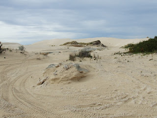
and it turned out to be quite fun, tracks go all over the place with not much signage, only orange posts to guide the way (as long as the slasher tractor who had been through before us hadn’t cut them in half). There were rocks to drive over and then we found we were on the park boundary road so we headed back to the sandy coastal track and we found ourselves on a huge sand dune and we had to get out of the car to see where the track went as there were tracks all over the place but we found a track over the edge of the sand dune and we were off again.
Cheers


No comments:
Post a Comment